2013/10/03

Arequipa, the white city.

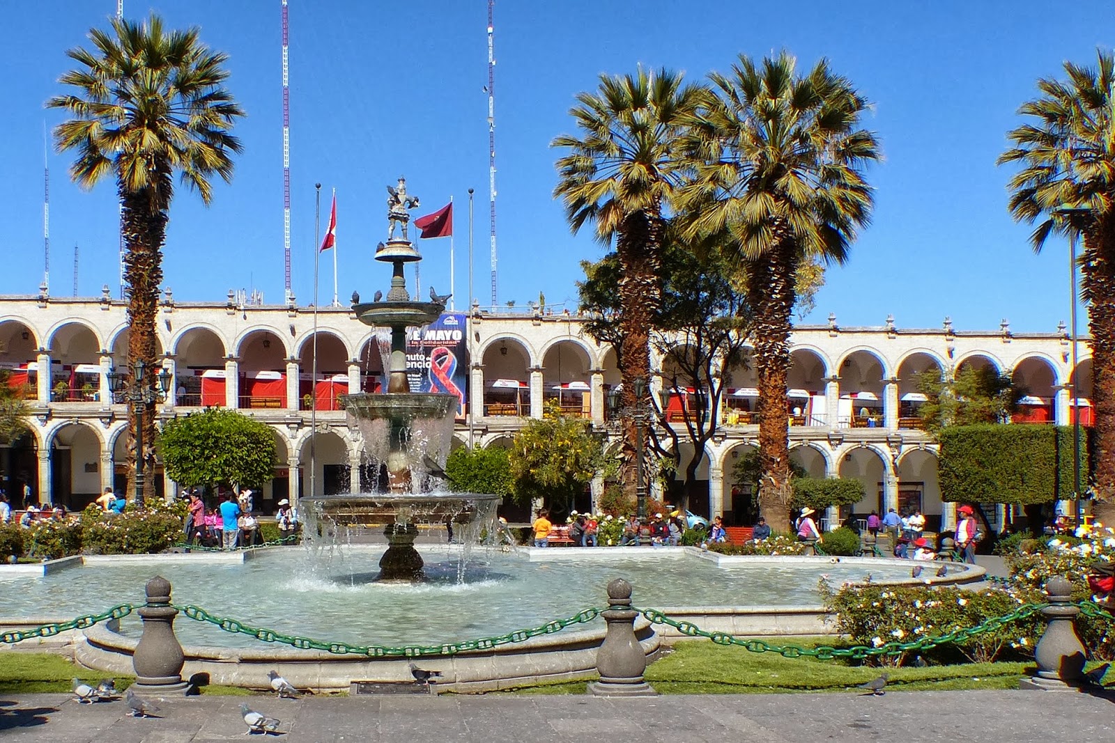
Arequipa is called the white city because the cathedral, the colonial buildings with colonnades around the central square, the Plaz de Armas, and most of the houses are build with white (very light grey) volcanic stones. In the Peruvian sunlight this looks very bright.


 Entrance of the Cathedral.


We arrived in the morning after a trip on a night bus. So first we had breakfast at the Plaza de Armas in a restaurant on the first floor with a good view of the Cathedral (1612) and overlooking the Plaza.

Every time the towers were damaged by one of the many earthquakes they were rebuilt.


I did my best to get a decent picture of this very, very long front of the Cathedral.


Sitting on the fist floor it is nice to watch the activities in the square.


There are lots of people who cannot read or write in Peru. Here in Arequipa they go to the square, where there are some men with typewriters who will write a letter for you.
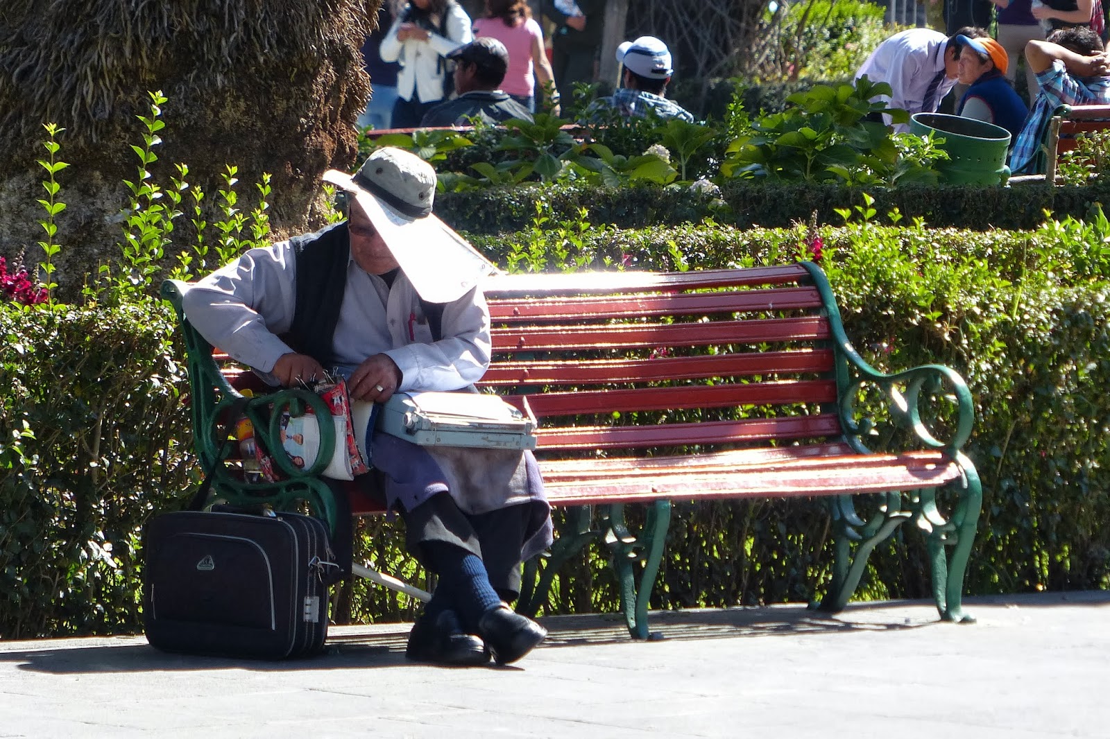
It is also a good place to read the morning newspaper.

Or to prepare the goods to sell today.

We could stay in Arequipa all day. So we went to see Juanita, the mummy that was found in 1995 on the slopes (near the top) of the volcano Ampato. The girl climbed the mountain 500 years ago as a gift to the gods by the Inkas. It was worth going there, but no pictures (anyway it was far to dark inside to take pictures). Amazing how well the clothes and her body are preserved. Take care to wear a fleece when you go to the museum (Musea Santuario Andinos) it was freezing cold in the museum.

We also went to the market San Camilo and to the convent of Saint Catalina. More about this in the next blogs.

In the evening the Plaza de Armas is even more busy then in the daytime. 


Finally we sat down for some dinner in the small street behind the Cathedral. This day we really noticed that we were more than 2300 meters high up in the mountains. And this was only the beginning.


My companion told me the local beer was just fine.


2013/08/14

Mummies in Chauchilla

South of Nazca (Peru) lies the necropolis of Chauchilla. This cemetery was only discovered in the twenties of the 19th century. Only until recently the remains of the mummies were scattered across the dessert. Robbers had been around taking everything worth while. About 12 graves are now restored. They are open - underneath  some simple roofs. Some of the graves are for just one person. In others more people are buried. These might have been more important people, who were buried with their servants.


These mummies were buried around 1000 AD. Now we can still see clothes and hair. In some places there are even rests of skin. It feels awkward to look into graves. These people who were buried in the believe of being save for the things to come. I gives me a feeling of disrespect and yet I am prepared to look and take pictures.

The people were buried sitting in a foetal position. In pots they had food for the trip to the afterlife. 


Towards the end of the day the landscape becomes serene.


A beautiful place for a last sunset


Read more about the Chauchilla necropolis


Dry rivers and water wells.....


The water from the Andean mountains flows underground to the Pacific. Underneath the desert are so called aquifers; layers of permeable rock that contain water. The town of Nazca lies between two rivers...... very dry rivers.... Only once in 7 years there is water in the rivers.


One river ......

Another bridge over another river.....

 As a tourist you don't notice so much that the water is rationed in Nazca. People outside the center only have water for one hour a day (in the evening). And in some places (like this new settlement) there is probably no water t all.


From the sky you see signs of extensive flooding in the Nazca desert.


This looks amazingly the same as the muddy river beds in Iceland (Skaftafel - below) that go straight from the glaciers to the sea. Only in Iceland there is a lot of water flowing, here in Nazca it is completely dry. The color of the sediment is also very light like  in Nazca.


Already in Pre-Colombian times, around 550 AD, people new there was water underground in aquifers. To get access to the water the people built underground aqueducts (puquios) to reach the aquifers. To get to the water in the aqueducts they constructed spiral water wells. The water was used for irrigation of the fields and for consumption.

This aerial of the Cantalloc wells is a srceen print from Google Maps (thanks!).
This spiraling structure enables you to go down to the water.


There is the aqueduct with water down there


Amazing construction.


Here the aqueduct comes to the surface.


Interesting reading about the relation between the Nazca lines and underground water (Aquifers):
The Nasca Lines Project (1996-2000)
Nasca Puquios and Aqueducts


2013/08/05

The Nazca lines


The Nazca lines are lines of 10 to 15 cm deep in the Atacama dessert on the Nazca plateau In Peru. The surface of this desert is covered with red rocks (Pampa Colorada). There is no wind and no rain.


Looking from the Maria Reiche tower, the dessert is completely flat. On the other side of the road (the parking place - note the chemical toilet) you see the mountains.


To construct the lines the Nazca people removed the red stones to make the underlying bright lime visible. This was around 400 to 650 AD.

The lines in the desert of Nazca are best seen from the air. You're supposed to see something from the Maria Reiche tower (I didn't climb the tower) and from a mountain ridge, but the best view is from a plane. We flew in a small 5 passenger Cessna. Seats are distributed by weight. So in the airport we went on the scales with all the gear we wanted to take with us on the plane. I was seated in the back (rather low) but with a view on both sides....


In the airport there is a schematic map of the lines and figures that you get to see when flying over the desert.


This is an aerial view of the Maria Reiche tower. The little dots on the left of the road are chemical toilets and probably a car on the parking place. When you look good you can see lines and nearer to the tower to the right a figure with two large hands and a tree. In the left corner you some damage done by cars. The road was build before they new of the existence of the lines.


What are these lines for? There seems to be no certain answer. Possibilities enough. An Observatory to determine the time of solstice combined with religious functions. Is there a relation to the water management? The water that comes from the Andes flows underground to the Pacific Ocean ( in the next blog more about drought and water). Agriculture and fertility were the main topic of religion.

And there was Von Däniken with the theory of landing strips for astronauts from other planets. There is a figure called "the astronaut".


It was the first figure I saw. I missed the whale, but took a picture....


And here it is! We new they were hard to see and it was upside down. How could they see them standing just on a hill?

Here we see The Condor. And beautiful lines. No wonder people are so curious about their meaning / purpose.


A bit further on.... Two Frigate birds. One in the middle and one with the half circle (not so clear).

  On this promontory something that looks very much like a landing strip... with a Hummingbird.


 Then there is a Parrot ...

 ... and a Spider ....

 The Spider is also surrounded by fantastic lines.


Flying back we see more of the landscape. Dry, but with traces of rivers. Nothing seems to change in this landscape (as long as people don't interfere).

 Ah.. yes, the river..... Not a drop of water.


Almost back.....